From Dream to Execution
The course, The Iowa Idea at Great Heights Iceland High Altitude Balloon Project, has now made the pivot: from an ambitious spring semester to the summer field expedition in Iceland. Students - 20 - will be heading to Iceland, July 10–16, where they will test-launch the payloads they created. Outside the cameras two teams are using, all instrumentation was something they created/built/coded themselves. The July launches of their payloads is ahead of the August 12 solar eclipse missions, when the payloads will be launched again within the path of totality in the Westfjords.
We deployed the concpet of boundary object and the process of design thinking to anchor the teaching and learning.
Crazy! How did I get here?!
The spring course was ambitious, but wonderfully enough, the students work is off the charts ambitious and accomplished. The three teams "missions":
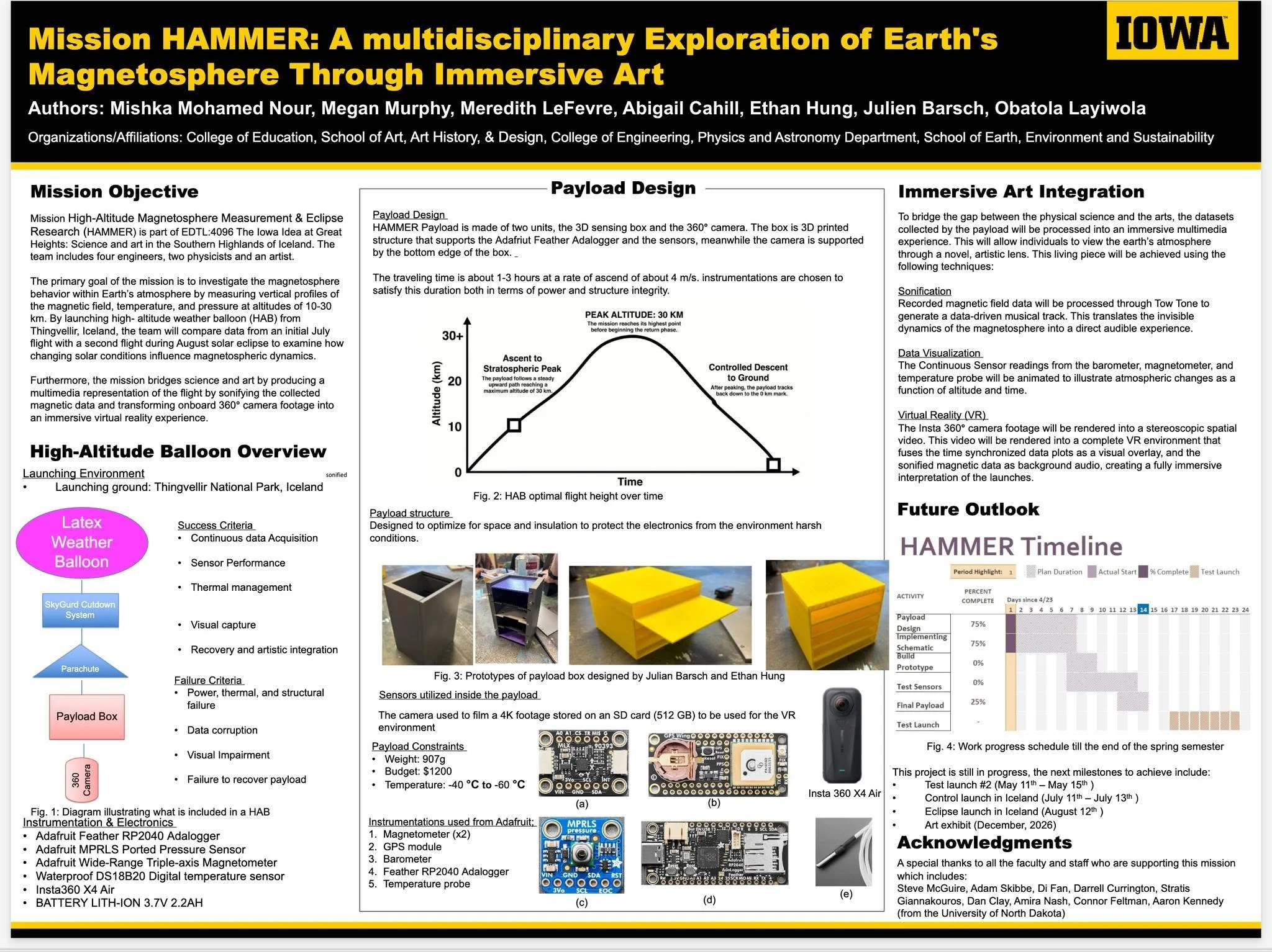
The Mission HAMMER team is looking upward to Earth's magnetosphere itself. Their project combines atmospheric science, magnetic field sensing, virtual reality, and immersive art to examine how solar conditions shape the upper atmosphere. The payload will gather magnetic, pressure, and temperature data while ascending to roughly 30 km and then transform that information into something more than a dataset: a multisensory experience. Recorded magnetic fields become sound, sensor streams become visual environments, and 360° imagery becomes an immersive virtual reality reconstruction of the atmosphere. Their work asks a strange and compelling question: what if atmospheric science could also be experienced as an artwork?
The Troll's Breath team directs attention toward Iceland's atmosphere itself, building a payload designed to map greenhouse gases across altitude profiles and potentially detect atmospheric changes during a solar eclipse. Their instrument suite tracks ozone, carbon dioxide, sulfur dioxide, nitrogen dioxide, pressure, humidity, and temperature. Yet the project is not only scientific. The students describe the payload as a "boundary object"—a human-made artifact placed into an otherwise wild landscape to explore the tension between industry and environment. Scientists, engineers, and artists collaborated to create a system intended not merely to collect data but to ask larger questions about human influence and environmental change.
Meanwhile, Rock'n Trolls turns its gaze downward toward Iceland's surface itself. Their payload combines custom-built spectroscopy, photogrammetry, and environmental sensing to create detailed three-dimensional reconstructions of Icelandic landscapes from above. Two cameras with overlapping fields of view will create photogrammetric maps while a spectrometer examines reflected light signatures to distinguish geological and environmental features. In practical terms, they are attempting to answer deceptively simple questions: What does Iceland look like from above? How is it geologically different from the United States? But underneath those questions sits something larger: a desire to merge imaging, remote sensing, engineering, and exploration into a new way of seeing landscapes.